
Sources for Previous Residents of a Yucaipa Address
The era table separates ownership, occupancy, and historical context. The assessor is current and valuation-focused. The recorder's online index begins in 1925 and identifies recorded parties, but the image is not online. NARA verifies San Bernardino regional directories that include Yucaipa Valley in four years. Federal census schedules are public through 1950 as of 2026. Permit files can date physical changes. Newspapers and probate can close a deceased person's trail. None of these alone is a complete list of previous residents.
| Source | Verified coverage | Where held | What it shows |
|---|---|---|---|
| Assessor valuation and parcel facts | 1978 to present historical valuation | San Bernardino County ARC | APN, roll owner, situs, values, characteristics |
| Recorder's Index | 1925 to present online index | ARC Official Records | Grantor, grantee, title, date, number; image by order or counter visit |
| Regional city directories | 1927, 1929, 1931, 1933 | NARA-listed San Bernardino volumes | Dated adult, household, address, spouse, and occupation clues |
| Federal census | 1850 through 1950 public | NARA and library genealogy access | Household members, ages, relationships, occupations, locality |
| City permit and code files | Date range not officially stated | Yucaipa Permit Exchange or CPRA request | Construction or administrative events at an address |
| Probate and newspapers | Title and case dependent | Superior Court, libraries, archives | Decedent, heirs, notices, obituaries, family clues |
Start with the era in question. For a recent transfer, use the assessor and recorder. For the early twentieth century, use the regional city directories and census. For a house's physical story, request permits, plats, aerials, and planning records. For a deceased owner, add obituary and probate searches after the parcel identity is secure.
Start a Yucaipa House History with the APN
Find the current parcel in Assessor Parcel Access using the exact situs address. Save the APN, roll owner, mailing destination when shown, legal description, lot or tract, and property facts. The APN fixes the land while names and street labels move. Use the map to check neighboring parcels and a plat to understand the lot, block, tract, easement, or original street layout.
Assessor historical assessment values reach from 1978 to the present. That series can date changes in assessed value, but it is not a complete chain of every owner or household. A deed shows ownership, not all residents. A city permit can date an addition or rebuilding event, but a named applicant or contractor is not automatically a resident. These distinctions keep previous-resident research tied to a real property question.
Begin with land identity. The efficient Yucaipa sequence is address to APN, APN to current owner, current owner to Recorder's Index, then deed image and earlier grantor.
Walk a Yucaipa Deed Chain Backward
The chain of title is the sequence of recorded transfers that connects one owner to an earlier owner. In Yucaipa, the online recorder search cannot start with an address. Search the assessor owner as a grantee, select the deed that matches the APN or legal description and likely date, then read the seller or grantor from the image. Search that seller as a grantee in an earlier period. Repeat while checking that the same land, not just the same surname, is involved.
- Pull the current roll owner and legal description from county Assessor Parcel Access.
- Search the current owner as grantee in the Recorder's Index and filter by date or document type.
- Order or view the matching deed, then record seller, buyer, document number, date, and legal description.
- Search the prior seller as grantee and match the identical lot, block, tract, or APN before moving back.
- Repeat to the 1925 online boundary, noting trusts, quitclaims, reconveyances, and intra-family transfers.
- Ask ARC, the State Archives, or FamilySearch about earlier deed books or grantor-grantee indexes.
- Grantor
- The party conveying or giving an interest in the recorded instrument.
- Grantee
- The party receiving the interest in the recorded instrument.
- Chain of title
- The linked transfer history for one parcel or legal description.
- Legal description
- Formal land identity that can control when a street address changes.
Yucaipa Recorder Access: Free Index, Actual Instrument
The Recorder's Index is free to search from 1925 forward. It displays the locator fields: party role, document number, recording date, and title or type. It does not display the deed image, signatures, consideration, or full legal description online. View the instrument at the Hall of Records or High Desert Government Center, or order it through the county process.
For July 1, 2026, the research records $4 for the first page and $1.50 for each later page, with separate certificate, regular-mail, and priority-mail charges. The county estimates many mail orders return in one to two weeks and encourages appointments. A map purchase is routed to the San Bernardino Hall of Records. Confirm the live fee schedule before sending money.
| Online index | Party, title, date, number, and locator information from 1925 forward. |
|---|---|
| Counter or ordered image | Substantive instrument, legal description, signatures, and recorded details. |
| Earlier books | Ask ARC, State Archives, or FamilySearch about pre-1925 catalogs and microfilm. |
What Happens Before Yucaipa's 1925 Web Cutoff
The 1925 boundary is the start of the public online index, not the start of Yucaipa deeds. San Bernardino County was created in 1853. Older deed books, grantor-grantee indexes, maps, probate, and county records can predate the web series by decades. A research request should say whether it concerns a deed book, index, plat, map, probate file, or other record category. “Everything before 1925” is too broad for a useful custodian search.
Yucaipa's incorporation in 1989 adds another layer. Pre-incorporation property and permit records were county-centered, while modern city records carry later local planning and permit material. Search “Yucaipa Valley,” rural routes, Crafton vicinity, and county territory when an old address will not match. The research did not verify a blanket street-renumbering event, so resolve continuity with plats, APNs, and legal descriptions.
Yucaipa Valley Directories for Past Households
Ownership is only half of a house history. NARA's regional directory note identifies Yucaipa Valley inside San Bernardino volumes for 1927, 1929, 1931, and 1933. A directory can list an adult at a street address, with spouse, occupation, telephone, residence mark, or business detail depending on the volume. A renter or adult household member may appear even though no deed names that person. Read the abbreviation key before interpreting a symbol.
Pair 1929 or 1931 with the 1930 census. A directory gives a local address clue, while the census can add household members, ages, relationships, and occupation. A missing entry may mean a move, death, rural omission, unlisted status, a missing year, or a catalog gap. The Yucaipa city directory collections page explains the regional catalog search and household tracing method.
Yucaipa Census, Permits, and 1978 Values
Use a census schedule to anchor a household to a decennial snapshot. Use a permit or code file to date a physical change. Use historical assessment valuation to mark a property timeline from 1978 forward. These dates do not automatically identify a resident. They become meaningful when the address, parcel, and record role agree.
| Clue | Question answered | Limit |
|---|---|---|
| Census | Who was counted in the household at a dated snapshot? | Not an annual address history |
| Permit Exchange | What project or code event occurred at the address? | Applicant or contractor is not necessarily a resident |
| Assessment valuation | How did a property value or characteristic change? | Not a complete owner or household list |
| Recorded deed | Who transferred an interest in the parcel? | Does not list every occupant |
No Verified Yucaipa Sanborn Edition
No Yucaipa-specific Sanborn edition was established in the research. The Library of Congress collection search did not locate one, and a city environmental report also stated that Sanborn maps were not available for a subject Yucaipa property. That gap matters because Sanborn maps are often used to reconstruct building footprints, but their absence does not erase a house history.
Use subdivision plats, assessor maps, aerials, permits, city environmental files, historic photographs, newspapers, and directory addresses instead. An environmental file may summarize a commissioned city-directory or historic-map search for a development parcel. Treat its summary as a lead and preserve the report title and property description. A plat and APN are usually better than a guessed street rename.
Yucaipa Obituaries, Probate, and Heirs
When a previous resident died, an obituary can point to relatives, a former address, service details, and a date. Probate can show a decedent, petitioner, heirs, notices, and estate addresses in permitted filings. A later deed can show a distributee or heir only when the legal description matches the same property. Verify a death event with the official certificate route and read a court record in its full context.
The California Controller's unclaimed-property search can also surface an old reported city or address. It is a last-known-affiliation clue, not current residence proof. Search a name and location, preserve the result date, and use it to choose a newspaper, probate, or deed follow-up. A deceased person's record can support family history without becoming a claim about a living person's whereabouts.
The California Controller's unclaimed-property search is the free state route.
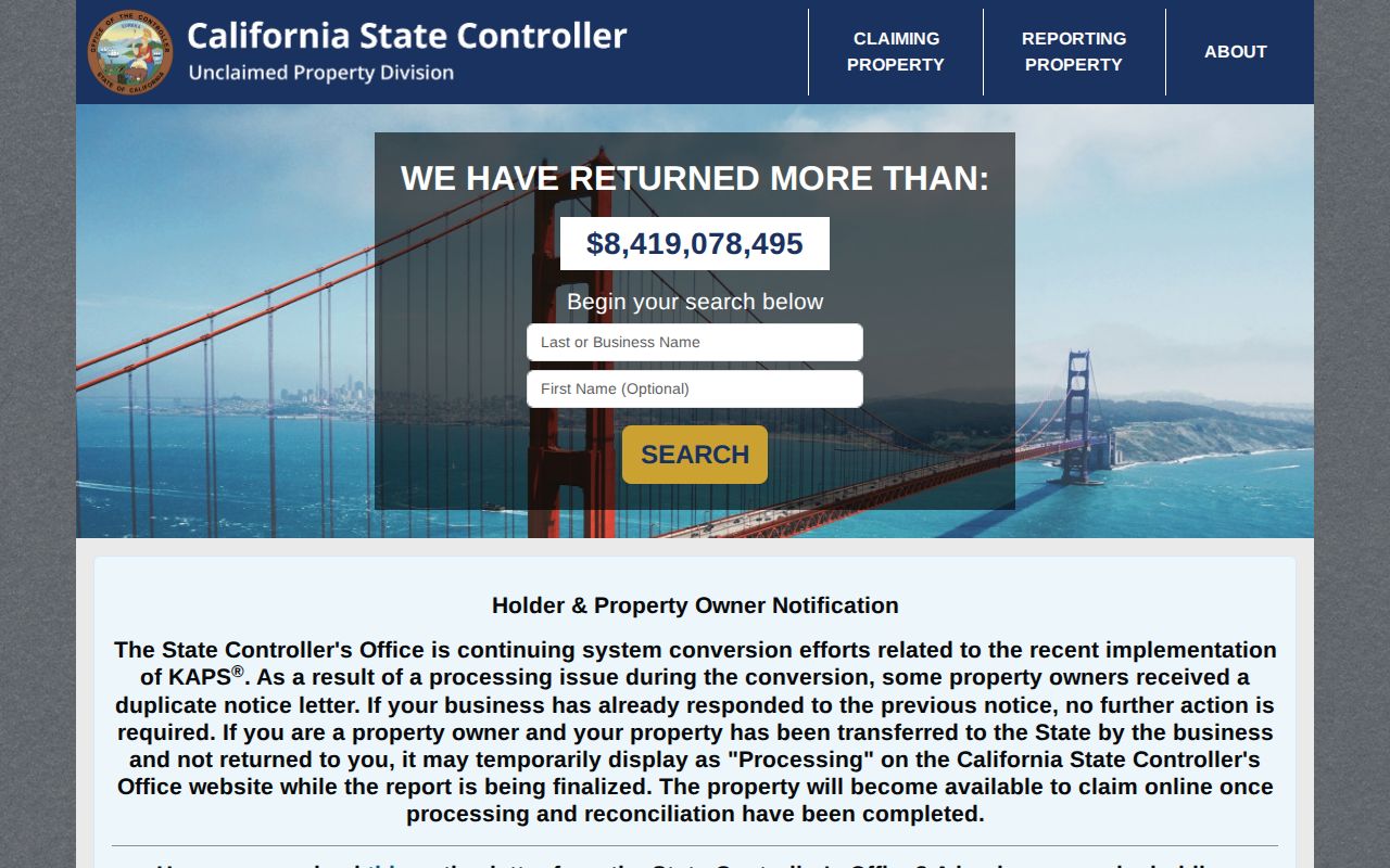
The state search image shows a last-known-location lead. It should be paired with an official property, court, or vital record before a family connection is accepted.
Yucaipa Address Labels Before Incorporation
Older sources may use Yucaipa Valley, a rural route, county territory, or a nearby community label. The modern city incorporated on November 27, 1989, so a historic directory or deed may not use today's jurisdiction language. Search locality variants together, then use tract, lot, block, plat, APN, or legal description to decide whether the old address is the same land.
Main corridors such as Yucaipa Boulevard, Oak Glen Road, Bryant Street, Fifth Street, County Line Road, and Wildwood Canyon Road can guide a search, but a corridor name is not a boundary proof. Planning and environmental materials may show annexation context around Bryant Street and Highway 38. Use the city's document and planning records for that specific parcel rather than assuming a citywide change.
Lawful Yucaipa House History
Previous residents research is suited to family history, house history, estate work, and personal curiosity. An old address does not authorize tracking a living person. Non-owner household members, minors, utility customers, protected voters, and Safe at Home participants may not appear. A blank source is not a reason to seek a private substitute.
Lawful use. Keep a house history tied to its parcel, date, and public source. Do not use past-resident records to stalk, harass, threaten, or harm anyone.
When the evidence ends, record the gap. The honest result may be a current APN, a 1929 directory clue, and an unresolved span between them. A previous residents note should cite the parcel, date, and custodian. That is more useful than a fabricated chain of previous residents.